News Summary
An updated weather alert from the National Weather Service has been issued for severe thunderstorms affecting Wilson, Nash, Edgecombe, Johnston, and Wayne counties. Residents can expect strong winds up to 50 mph and frequent lightning strikes. Those outdoors are advised to seek shelter immediately. The alert remains in effect until 8:45 p.m. as storms move eastward at approximately 25 mph, bringing potential for localized damage and hydroplaning hazards.
Wilson, North Carolina—Severe Thunderstorm Alert Issued for Multiple Counties
An updated weather alert has been issued for parts of North Carolina, including Wilson, Nash, Edgecombe, Johnston, and Wayne counties. The alert was issued by the National Weather Service (NWS) Raleigh NC on Thursday at 7:55 p.m., warning residents about strong thunderstorms that are expected to continue until 8:45 p.m.
Details of the Storms and Expected Conditions
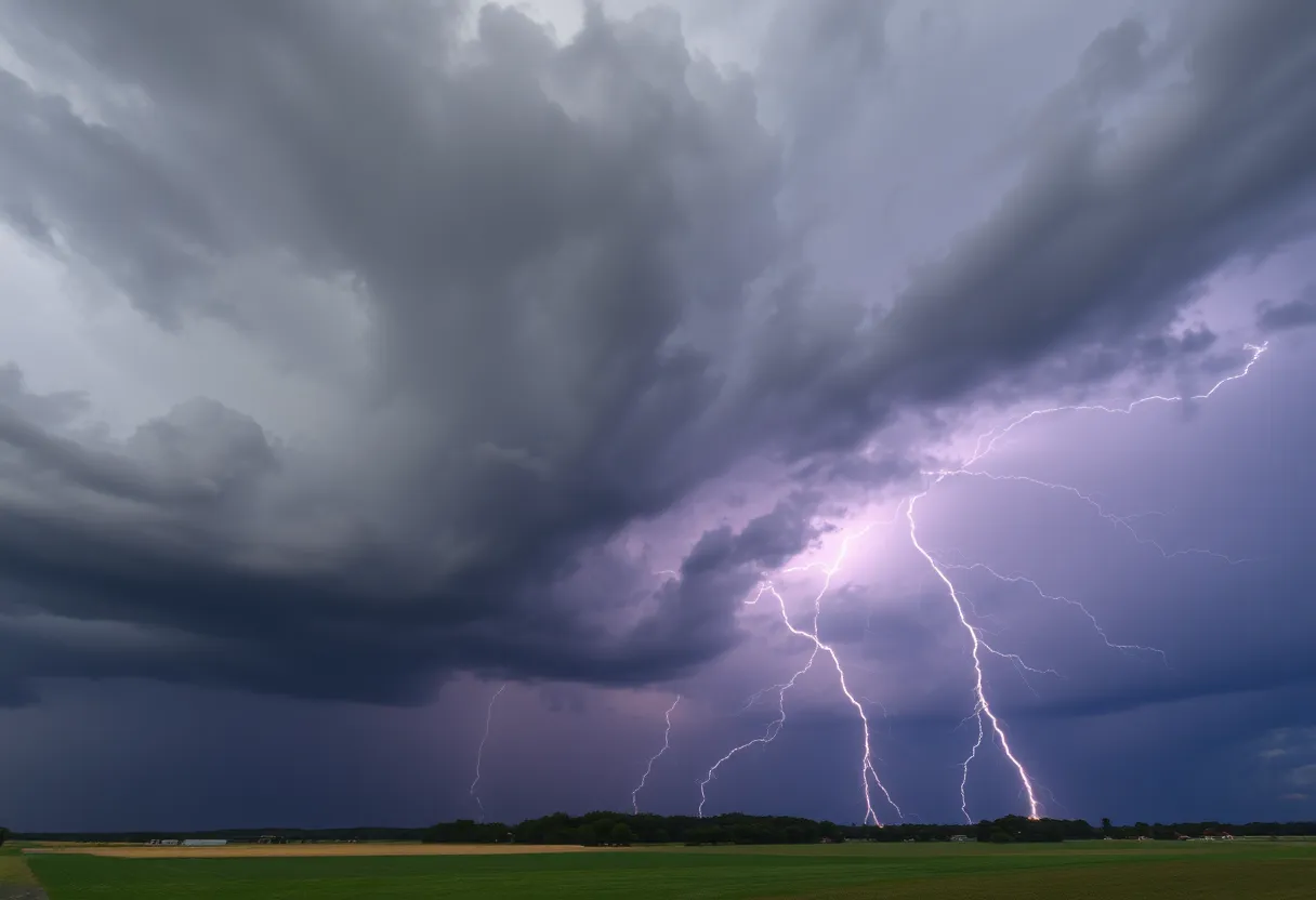
The alert indicates that these thunderstorms are capable of producing wind gusts reaching speeds of up to 50 miles per hour. According to Doppler radar data, a line of strong thunderstorms has been tracked moving eastward from Elm City to near Fremont, and then to six miles south of Smithfield. The storms are advancing at a speed of approximately 25 mph.
Residents in affected areas may experience gusty winds that could cause localized damage, such as knocking down tree limbs or blowing around unsecured objects. The primary impacted locations include cities and towns such as Rocky Mount, Goldsboro, Tarboro, Smithfield, Wilson, Benson, Elm City, Fremont, Micro, and Selma.
Safety Recommendations During Storms
The NWS recommends that anyone outdoors during these storms should immediately seek shelter inside a sturdy building. The storms are producing frequent lightning strikes to ground, which can occur up to 10 miles away from the thunderstorms themselves. For safety, individuals are advised to stay inside until the storms have passed.
Lightning causes approximately 25 million hits across the United States each year, primarily during the summer months. Though most lightning strikes occur during thunderstorms, around 20 fatalities are reported annually due to lightning-related incidents. The risk of lightning strikes increases as a storm approaches and peaks when the storm is directly overhead, then decreases as the storm moves away.
Additional Weather Hazards and Precautions
Besides wind and lightning, motorists and residents should be aware of the risk of hydroplaning. Hydroplaning occurs when a vehicle slides uncontrollably over wet surface roads due to water buildup in front of the tires. Factors that heighten this risk include high vehicle speeds, worn tires with insufficient tread, and deeper standing water on the roads.
Summary of Key Facts
- The weather alert is effective until 8:45 p.m. on Thursday.
- The affected counties are Nash, Edgecombe, Johnston, Wilson, and Wayne.
- The line of thunderstorms is moving east at 25 mph, with radar indicating storms from Elm City to near Fremont and south of Smithfield.
- Wind gusts may reach up to 50 mph, capable of causing minor damage.
- Locations impacted include Rocky Mount, Goldsboro, Tarboro, Smithfield, Wilson, Benson, Elm City, Fremont, Micro, and Selma.
- Frequent cloud-to-ground lightning is occurring, which can strike up to 10 miles from the storm.
- Safety measures include seeking shelter indoors and avoiding outdoors until storms pass.
- Lightning strikes cause about 25 million incidents annually in the U.S., resulting in approximately 20 deaths each year.
- The likelihood and intensity of lightning increase as the storm approaches and peak when it is overhead.
- Hydroplaning risk is heightened during heavy rain, especially at high speeds, with worn tires, or on roads with standing water.
Residents are urged to remain vigilant and take appropriate precautions during these storms to ensure safety until conditions improve.
Deeper Dive: News & Info About This Topic
HERE Resources
North Carolina Faces Hazardous Weather Conditions Due to Coastal Storm
LaRue County High School Implements New Dismissal Procedures
Central North Carolina Faces Severe Thunderstorm Warnings
Severe Thunderstorm Warning Issued for Wilson and Wayne Counties
Additional Resources
- CBS17: Severe Thunderstorm Warning for Johnston County
- News Observer: Severe Weather Update
- ABC11: Strong Afternoon Storms in Central NC
- Wikipedia: Thunderstorm
- CBS17: Flood Watch in Central NC
- Google Search: Weather Alerts North Carolina