News Summary
Wilson and Wayne counties in North Carolina are under a severe thunderstorm warning as a strong weather system approaches the region. The National Weather Service has issued alerts for potential hazards, including dangerous wind gusts and heavy rainfall, leading to localized flooding. Residents are advised to seek shelter indoors and remain cautious, with forecasters predicting ongoing storm activity throughout the weekend and the risk of flash flooding lingering into next week.
Wilson and Wayne Counties Face Severe Thunderstorm Warning as Central North Carolina Weather Develops
Wilson and Wayne counties in North Carolina are under a severe thunderstorm warning until 12:15 a.m. Sunday, as a strong weather system approaches the region. The National Weather Service (NWS) Raleigh NC issued the alert late Saturday night, citing dangerous weather conditions that could affect local residents over the coming hours.
Details of the Storm and Immediate Impacts
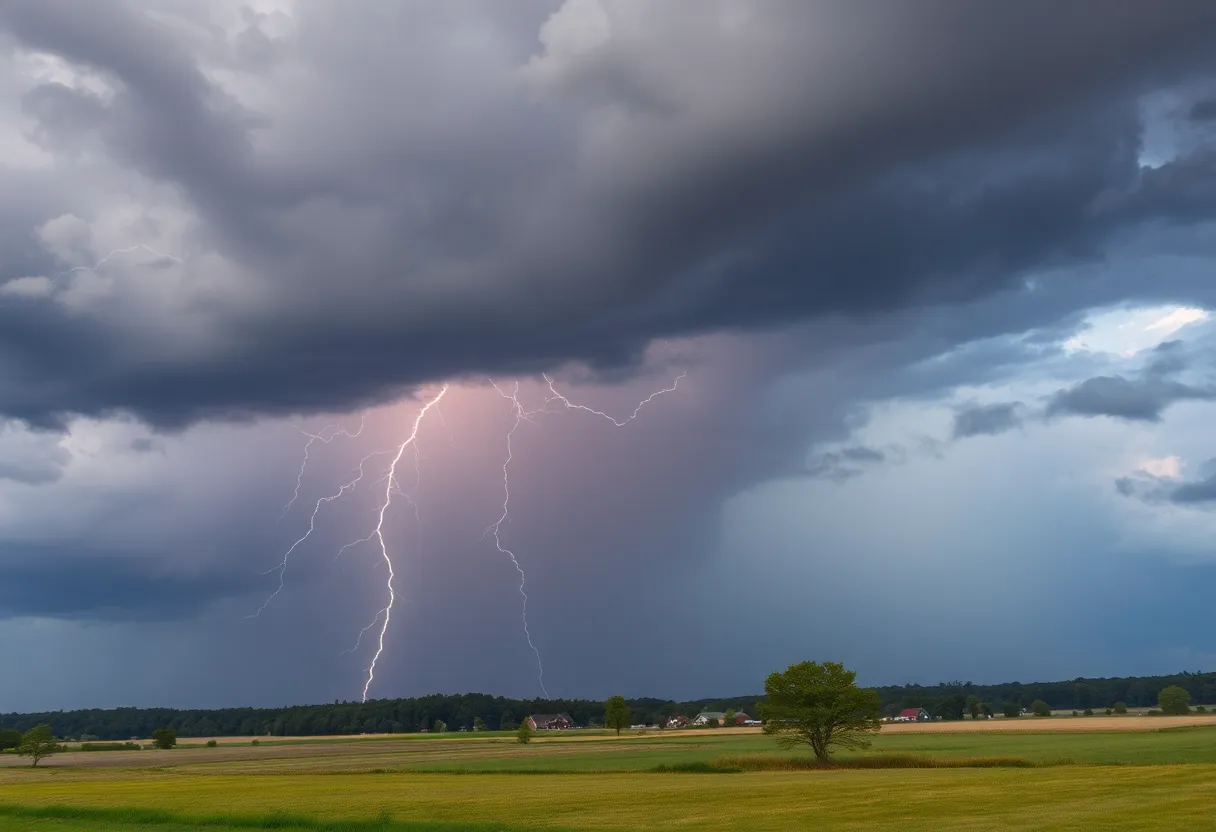
At approximately 11:27 p.m. Saturday, Doppler radar detected a strong thunderstorm situated over Fremont, a location roughly 10 miles north of Goldsboro. The storm was observed to be almost stationary at that time, posing ongoing risks of wind and rainfall. Wind gusts of up to 30 mph are possible, which could cause damage to trees, power lines, and unsecured objects in the affected areas.
Communities including Goldsboro, Fremont, Black Creek, Pikeville, Eureka, and Nahunta are impacted by the warning. Residents in these areas are urged to seek shelter indoors if they are outside, especially given the potential for gusty winds and heavy rainfall.
The storm is accompanied by torrential rainfall, which may lead to localized flooding, especially in low-lying or poorly drained areas. Motorists are advised against driving through flooded roadways to prevent accidents and slow response efforts. The combination of fast-moving water and ongoing rainfall increases the risk of flash flooding in urban and rural parts of central North Carolina.
Lightning and Other Weather Hazards
Lightning strikes are common during summer thunderstorms, with the US experiencing approximately 25 million lightning hits annually. The risk of lightning is heightened as the storm approaches and peaks when the storm is directly overhead. Lightning causes about 20 fatalities each year nationally, highlighting the importance of taking precautions during thunderstorms.
Once the storm moves away from the area, the lightning risk diminishes. Residents are encouraged to remain indoors during and immediately after the storm to stay safe from these hazards.
Broader Weather Conditions and Forecast
A Hazardous Weather Outlook has been issued for the central North Carolina region, emphasizing the potential for severe weather. The forecast for Saturday includes a 40% chance of precipitation, driven by high humidity levels at 82% and morning temperatures around 79°F. The heat index is expected to reach 105°F, creating uncomfortable and potentially hazardous conditions for outdoor activities.
Thunderstorms are expected to persist through the weekend, especially during peak daytime heating hours. The ongoing weather system may cause isolated instances of flash flooding, with areas already affected by recent heavy rainfall remaining vulnerable.
Current Flooding and Emergency Responses
In addition to the storm warning, Johnston County remains under a Flood Warning until 1:15 a.m. Sunday. This warning signifies ongoing or imminent flooding risks, particularly in urban zones prone to rapid water accumulation. Authorities caution residents to avoid travel in flooded areas, reinforcing the dangers posed by swift-moving floodwaters.
Recent events across the Triangle and central North Carolina have seen significant flooding, with authorities declaring a state of emergency in Alamance, Moore, and Orange counties. These declarations are in response to storm-related damage and ongoing risks to public safety.
So far, at least six deaths have been attributed to recent storms, underscoring the serious threat posed by severe weather conditions in the area.
Upcoming Weather Outlook
Forecasts indicate that the current thunderstorms are expected to clear out by Friday evening as they move off the coast. However, the region remains at risk of isolated flash floods into the upcoming week due to an active weather pattern. This pattern is characterized by intermittent thunderstorms, including some that could develop into strong or severe storms during peak heating hours.
Residents are urged to stay informed about local weather updates, remain vigilant during storms, and follow safety guidelines to protect themselves and their property as the weather continues to be unpredictable through the weekend and into next week.
Deeper Dive: News & Info About This Topic
HERE Resources
Additional Resources
- News Observer: Severe Thunderstorm Warning in NC
- Wikipedia: Thunderstorm
- ABC11: First Alert Day Forecast for NC
- Google Search: Severe Weather North Carolina
- News Observer: Ongoing Flooding in NC
- Google Scholar: Severe Weather Impacts North Carolina
- Hoodline: Raleigh Prepares for Severe Weather
- Encyclopedia Britannica: North Carolina Weather
- ABC11: Tropical Depression Chantal News
- Google News: NC Flooding 2023